Utterly enthralled by the enigmatic nature of dramatic thunderstorms, a photographer from Darwin sets off on a mission to record these beautiful and frightening spectacles in all their glory.
By Jacci Ingham
My name is Jacci Ingham from Darwin in Australia’s Northern Territory. I am a local nature photographer and storm chaser who has a passion for Northern Australia’s weather and the great outdoors. Since I was a child, I used to dive into non-fiction books about climate and weather, the type of books that may be considered unusual for a 10-year-old to be so engrossed in.
I have always been captivated by the mysterious nature of thunderstorms – they can be both frightening, yet very beautiful at the same time. My passion for photography comes from my fascination with nature and an artistic side that I have had since birth.
I have grown up in the Territory for most of my life and have spent half of it living in Darwin, the Northern Territory’s capital, and I have been chasing thunderstorms in this region for the last decade.
Northern Australia – Climate and Lightning Strikes
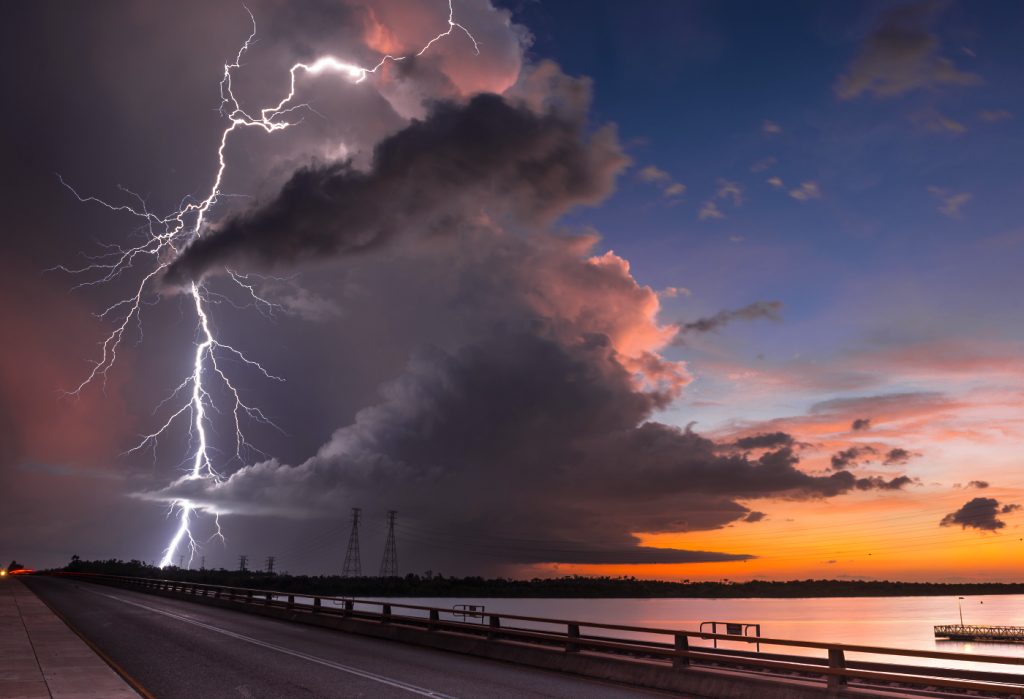
Northern Australia has a tropical savannah climate with two distinct seasons, the wet season and the dry. Specific climates range from semi-arid tropics further inland to the wet/dry tropics on the far northern coast. It is well known as a tourist destination for dry-season visitors escaping the cool of the southern winters; it is also well known for its high wet-season humidity and spectacular lightning storms during the build-up and wet-season months.
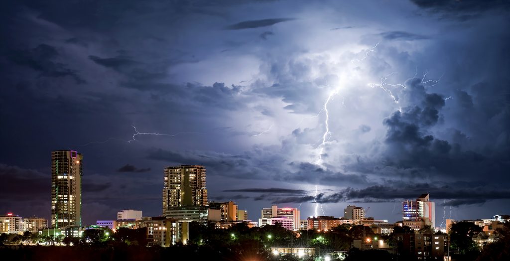
This has become a drawcard for both local and overseas photographers and weather enthusiasts wanting to witness firsthand these amazing light shows. The areas surrounding the northern third of the Northern Territory and the Kimberley regions of Western Australia are the most storm-and lightning-prone areas of Australia, with Darwin receiving in excess of 80 thunder days per year.
The Mitchell Plateau in the far northern Kimberley Region of Western Australia peaks with the highest annual lightning density in the country – over 25 strokes per square kilometre, according to the Australian Government Bureau of Meteorology’s lightning data maps.
Darwin’s Famous “Clear Air” Lightning
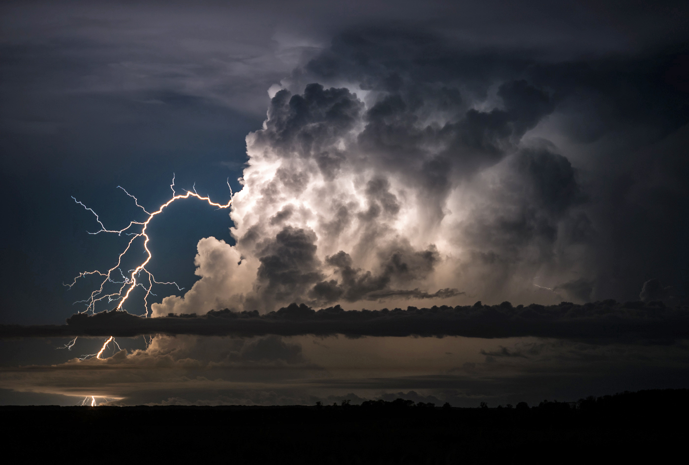
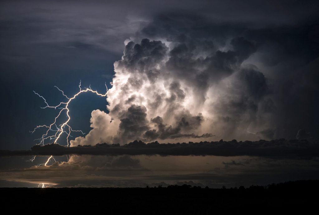
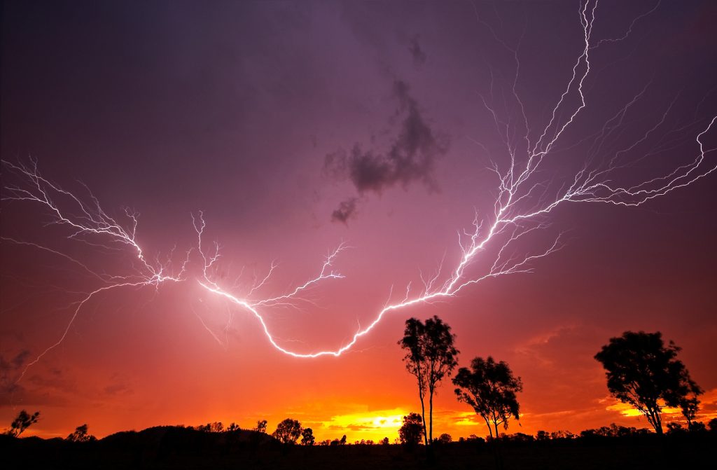
The storms here really are spectacular. In the build-up months, it is those clean “big sky” storms that are highly sought after for their photogenic qualities. They produce impressive “nuke bomb” cumulonimbus clouds with boiling bubbly structures that can attain heights of over 19,000 metres on a good day.
These storms frequently glitter with lightning and are capable of throwing out clear air strikes up to 15 kilometres away from the parent storm! These strikes are often referred to as “the bolt from the blue”, or more locally nicknamed “dog legs” for their habit of spitting out the top of the storm then taking a sudden downward turn to the ground a fair distance away from the storm like an “angry Tesla coil”.
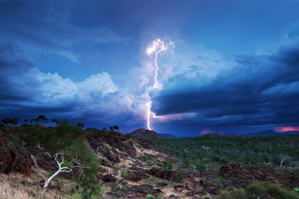
Incorporated with the stunning remote scenery of this region, there is nothing more invigorating than watching a massive storm build-up in
a remote location over a vast savannah plain or lush tropical wetland. Just you, the birds and the thunder. Magnificent!
Types of Storms
Storm chasing in Darwin is different to that on the Great Plains of the US, which is what one typically thinks about when one talks about
chasing storms.
The atmospheric dynamics and triggering mechanisms that initiate storms here are a different beast. Normally, wind shear in this region is low to moderate at best, unlike the US, where high wind shear and upper level jet streams are a regular occurrence.
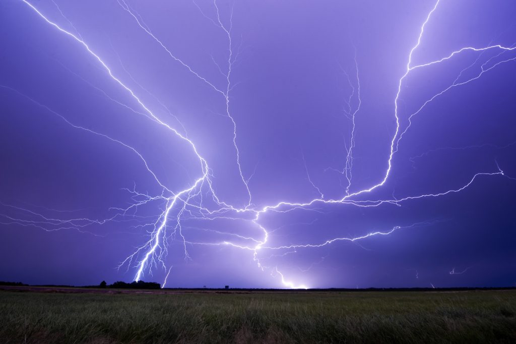
Northern Australia is well within the tropics and as such, instability is abundant. However, supercell thunderstorms are considered rare. The most typical storm types one will witness in this part of the world are single-celled pulse thunderstorms and multicell thunderstorms. These are generally more short-lived thunderstorms, but when they reach their prime, their lightning intensities are vigorous.
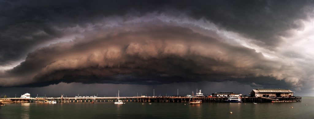
Even non-severe thunderstorms can produce amazing displays. Many of Darwin’s afternoon thunderstorms are triggered by convergence along northwesterly sea breeze boundaries as the sea breezes push inland. Longer-lived thunderstorms in Northern Australia are mostly large, persistent multicell clusters known as mesoscale convective systems (MCS) and also squall line thunderstorms.
These storms can live for several hours in the right conditions. Large boundaries such as continental lines, Gulf lines and short wave troughs create plenty of convergence and are capable of triggering these longer-lived storms.
I have had my fair share of close calls with lightning in the past. It doesn’t deter me from chasing storms, but it does give me a sobering reminder of how unpredictable nature can be and to exercise much caution when in close proximity to any thunderstorm, big or small. It is experiences like these over the years that have given me wisdom and a humbling understanding of just how insignificant we truly are against the power of nature.
For more stunning stories and photographs from this issue, check out Asian Geographic Issue 109.


