A tale of a shifting Earth
Text YD Bar-Ness
Today, we look at the familiar map and see the seemingly stable shapes of the land, but we are just catching a moment in a much more complex dance.
Two hundred million years ago, the continents were together in the most recent supercontinent, known to paleogeologists as Pangaea. The continents of today are now coming apart from that configuration. On a spherical planet, however, the continents will inevitably, eventually come together in a completely new configuration.
Combining geological and biological evidence, it is possible to piece back together some details of Pangaea’s shape and division, and the corresponding effects on the distribution of plants and animals we see today. As new scientific techniques uncover more evidence, we can look deeper into the past and discover the shape of the supercontinents that preceded Pangaea, and use that to predict the supercontinents of the future.

Migrating Continents
The first place to start is with a map. The shapes of South America and Africa mirror each other, but only in the 20th century was an explanation proposed to explain this. The theory of continental drift, proposed by the German meteorologist Alfred Wegener in 1915, proposed that the continents were floating on a liquid surface. They were slowly breaking apart from a single piece, and these two coastlines represented one of the rifts. His theory was also supported by the presence of matching fossils from the continents of the Southern Hemisphere, but at the time was rejected by the geological community.
Much later, in the 1960s, the mechanisms driving this dance were finally understood. Sonar technology had detected the presence of a long, symmetrical mountain range in the middle of the Atlantic Ocean, and the American oceanographer Harry Hess correctly hypothesised that seafloor was being churned out from deeper within Earth and widening the Atlantic Ocean. This rift – which had formed below dry land when the continents were together – was pushing apart the Americas from Eurasia and Africa. On the back side of these continents, the vast mountain ranges of the Americas’ west and the East Asian volcanos were being triggered by the continents pushing into and over the rocks of the Pacific seafloor.
As ocean floor is being uplifted and created in the mid-Atlantic, it is being driven down and destroyed at the leading edges of the continents. This led to the theory of tectonic plates, where large sections of the Earth’s crust are moving around slowly. There is an interlocked network of mid-oceanic ridges around the planet and their expansion drives the movement of the tectonic plates.
The Most Recent Supercontinent
With these basic concepts of migrating continents powered by a spreading seafloor, we can use fossil and geological evidence to reconnect the most recent supercontinent.
Between two and three hundred million years ago, there was Pangaea, from the Greek word for “all earth”. When it began breaking up, a rift formed between the north and south sections: Laurasia and Gondwanaland. Laurasia gave rise to Eurasia and North America, whereas Gondwanaland split apart into several smaller pieces, including Antarctica and Australia. Also fragmenting away from Gondwana were Arabia, India, Africa and South America. These all moved northward to collide and fuse into sections of Laurasia.
A vast terrain of mountains, plains and other unimaginable environments existed on this greatest of lands. In the interior, cold and dry conditions prevailed, and on the perimeter, a single vast ocean – Panthalassa – covered most of the surface of our planet.

Fossils From a Common Land
We normally think of animals migrating across a fixed landscape, but in the story of the supercontinental breakup it is the dry land itself that is migrating. We can get a sense of the inhabitants of Pangaea and Panthalassa from both fossil evidence and from their present-day distribution.
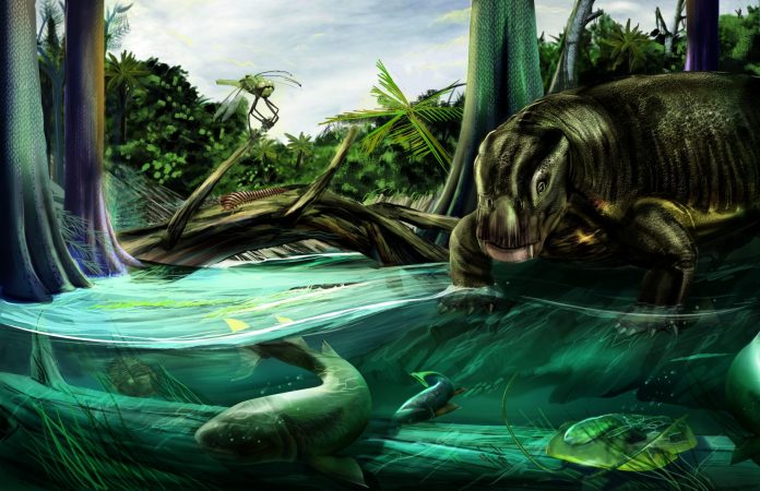
There are numerous lines of fossil evidence for Pangaea. Similar fossils found in now-distant regions can be explained by the supercontinent. In Wegener’s day, it was known that the fern-like Glossopteris fossils were found across Australia, Antarctica, Africa and India; and that fossils of the lizard-like protomammals Lystrosaurus and Cynognathus were found in the continents of the Southern Hemisphere.
In Pangaea, the ancestors of important groups evolved and thrived. Cycads, gingkoes and other gymnospermous plants formed forests and thickets. Cicadas and beetles appeared, and the reptilian ancestors of dinosaurs, birds and mammals began differentiating from a common reptilian ancestor.
Today, some organisms such as cycads and ginkgoes have retreated to a fraction of their normal range, and yet other groups originating in Pangaea have gone on to cover the globe. Birds, beetles and mammals have found homes in all of the lands of Earth. We could even think of ourselves as Pangaeans.
Before Pangaea
The continental configuration before Pangaea is a much greater mystery, as very little evidence has survived to the present day. One billion years ago, the supercontinent named Rodinia was surrounded by ocean in the Southern Hemisphere. After a half a billion years, it split apart into smaller pieces and triggered widespread volcanic activity. This brought mineral nutrients to the surface and helped the early marine life on Earth evolve more complex forms. As Rodinia disintegrated, rainfall rose and caused a lessening of carbon dioxide in the atmosphere. This in turn triggered the long period of cold temperatures known as Snowball Earth.
Around 1.8 billion years ago the supercontinent Columbia formed. Even earlier, at 2.7 billion years ago, when the Earth was half its current age, the supercontinent Kenorland existed for almost a hundred million years.
Before Kenorland, almost no definitive information exists. A continent named Vaalbara is suggested at by three billion-year-old rocks from Australia and South Africa. At around the same time, or possibly before that, another landmass called Ur was present, based on similarities in rocks found in India, Australia and Madagascar. Vaalbara and Ur were much smaller than the continents of today, and we can only imagine as to their shape and nature.
The Future Supercontinents
We are currently rafting away on the continents into an uncertain future. It seems that approximately every half-billion years, the continents find themselves clustered together in a new configuration rotated ninety degrees from the last supercontinent.
The current vectors of movement are known today: Africa is splitting apart in the eastern Rift Valley, and India continues to smash northwards into Asia, with Australia distantly following. On the far side of the planet from the Mid-Atlantic Ridge, the corners of North America and Asia are beginning to make contact at the Bering Strait.
Speculating forward from these dynamics, scientists have proposed possible configurations: it is possible that the pieces of Pangaea will find themselves colliding, back-to-back, on the far side of the planet in the Pacific, that they will again return to meet face-to-face in the Atlantic, or that they will cluster over the North Pole.
This new supercontinent will be home to future organisms whose ancestors have ancient ties to Pangaea. Unfortunately, we won’t be here to see it as it will take at least two hundred million years for Pangaea’s successor to form. We can only imagine.
For more stories and photos, check out Asian Geographic Issue 119.


